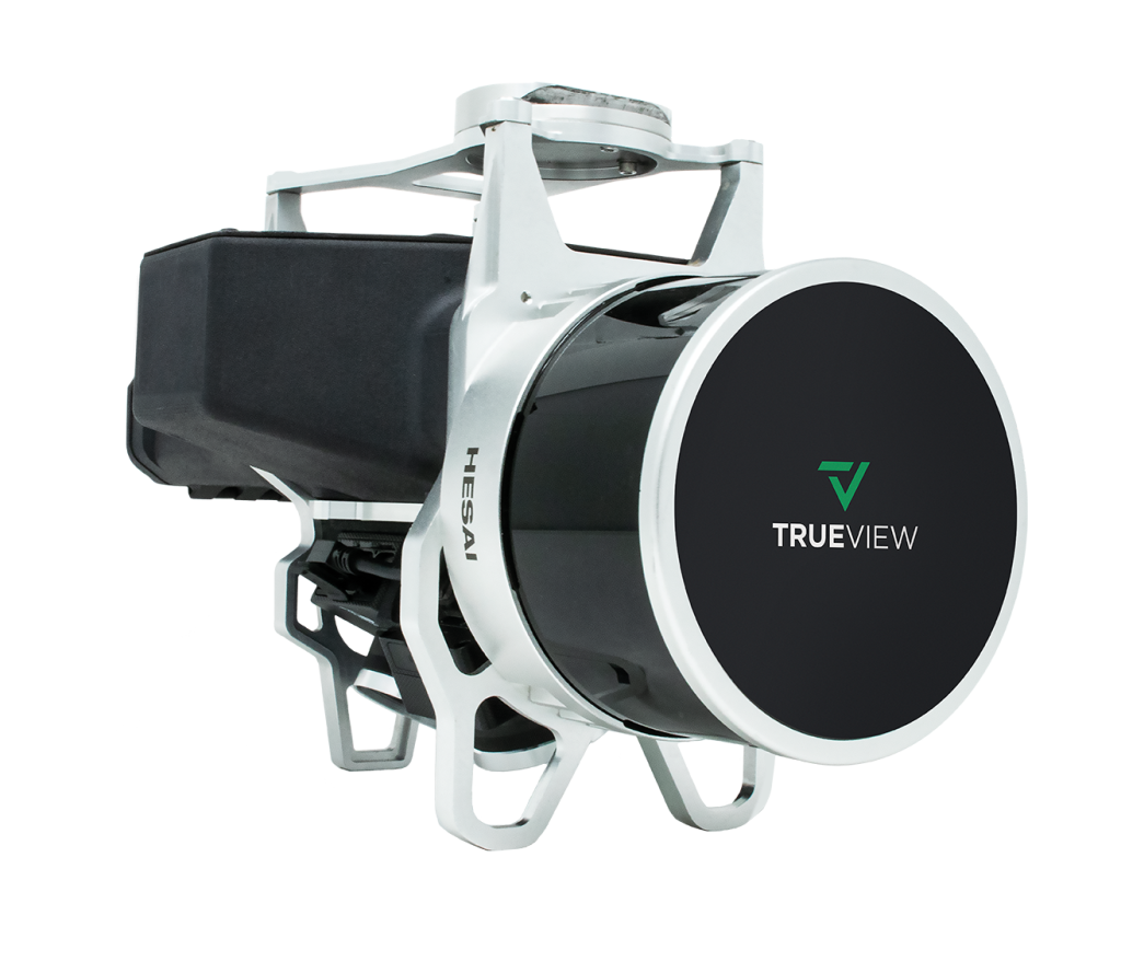
GeoCue’s TrueView 515 is simply the best performing LIDAR/Camera system in the mid price range. This compact 3D Imaging System has impeccable definition along wires, superior ground cover beneath vegetation and sensitivity like we’ve never seen in this class system.
Two GeoCue Mapping Cameras provide a 120° field of view, coincident with the laser scanner track. The 25° oblique mounting ensures the sides of objects are imaged, allowing a true 3D colorization of all LIDAR points.
The PandarXT-32 laser scanner provides range of up to 100m with two returns per outgoing pulse. High sensitivity enables superb detection of wires and ground beneath vegetation.
A Google® Coral TensorFlow Processing Unit provides exceptional power as the True View central controller. The CCU coordinates all on-board functions of the system.
A sensor can be no more accurate than the position and orientation system. GeoCue incorporates the industry’s most accurate and reliable POS – the Applanix APX series. APX post-processing is accessed via the included True View software, providing “pay-as-you-go” access to SmartBase and Trimble PP-RTX positioning services.
Post-processing software uses positioning system information to perform roll compensation at the individual scan line level. This allows reduced overlap between flight lines, increasing platform flight efficiency.
Fusing sensor data requires exceptional timing synchronization among the positioning system and all sensors. True View’s System Synchronization Unit (a GeoCue designed Master Clock), ensures sensor coordination at the microsecond level.
The professional choice in geospatial data processing software, made in the U.S.A. since 2006.
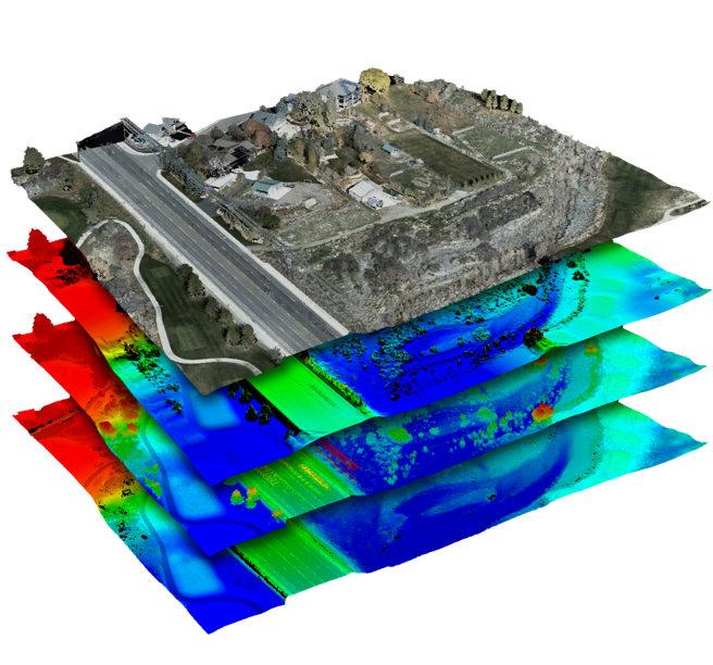
Whether it’s airborne or terrestrial collected LIDAR data, 3D point clouds have become a critical element in mapping. LP360, an advanced desktop LIDAR software package, makes easy work of extracting information and generating deliverables in an intuitive GIS environment.
Includes Strip Align and Photo Add Ons