GeoCue TrueView 720

Revolutionizing Corridor Mapping for Unparalleled Data Collection

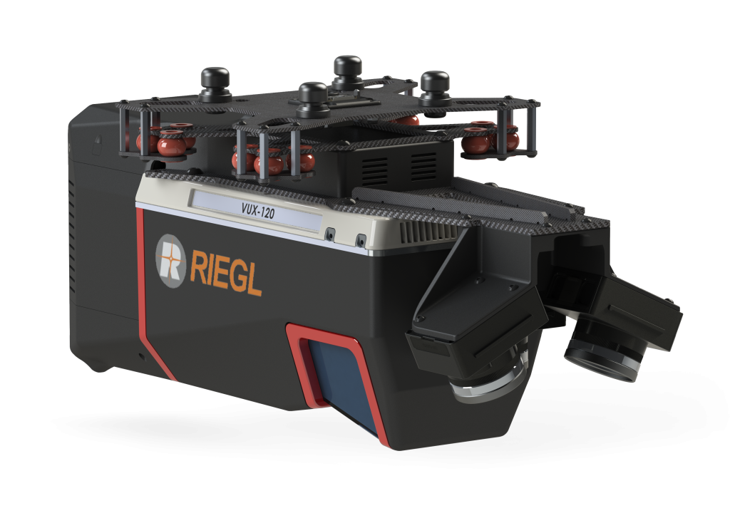
TrueView 720 is our fourth generation RIEGL integration. This is the system for high point density corridor mapping. Using the RIEGL VUX-120 with 3 lidar scanners (oriented nadir and +10 degrees forward and -10 degrees backward) and 3 oblique/nadir cameras for extremely detailed data collection in one flight path. When scanning power lines, users will be able to capture the poles vertically, front and back. Ask about custom camera configurations to cover your specific needs.

What's included

TrueView 720 LiDAR Sensor Payload

USB Thumbdrive

GNSS Antenna

Sensor Hardcase

Accuracy Star

SOFTWARE/DATA MANAGEMENT

LiDAR & photogrammetry 3D point cloud software

LP360 Drone Processing Software

The professional choice in geospatial data processing software, made in the U.S.A. since 2006.

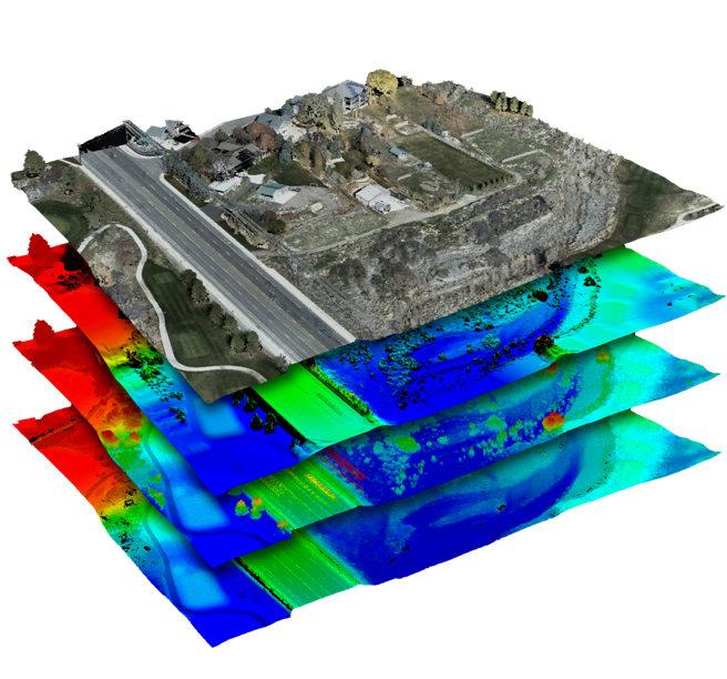
Whether it’s airborne or terrestrial collected LIDAR data, 3D point clouds have become a critical element in mapping. LP360, an advanced desktop LIDAR software package, makes easy work of extracting information and generating deliverables in an intuitive GIS environment.

Includes Strip Align, Photo, 3D Accuracy Add Ons

Specifications

Unveiling the Power and Performance Details

  • Data Collection LiDAR + Imagery
  • LiDAR Scanner RIEGL VUX-120
  • LiDAR Beams/Returns Up to 5 per outgoing pulse
  • LiDAR Range - usable 720 m for targets with > 20% reflectivity
  • Positioning and Orientation System Applanix APX-20, ask for other IMU options available
  • Pulse Repetition Rate Up to 2.4 Mhz (selectable)
  • Accuracy Typical: 1 cm*
  • Precision Typical: 0.5 cm*
  • Camera Sensor Triple 1” sensor with mechanical shutter, hardware mid-exposure pulse, 60 MP combined, RGB. Ask for further custom camera integration.
  • System Operation Temperature Range -10° to 40° C
  • Mass 3.4 kg
  • * 1 σ @ 150 m range under Riegl test conditions

Contact us for a free quote today!