The RECON-XT is the ultimate value, entry-level system for the DJI Matrice 300. A strong fit for smaller scan areas and teams on a budget. The RECON-XT is designed to grow and adapt with your business.
Flexibility in mounting options is a key benefit of this Phoenix system. The RECON-XT is designed to fly on the DJI M300, and can also be adapted for vehicle and backpack configurations.
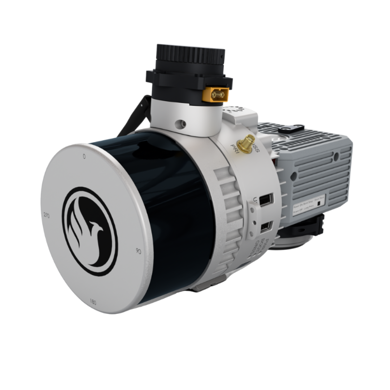
The newest generation, ultra-lightweight (450) rover will help meet the rigorous demands of various industries and applications by greatly increasing flexibility in two key areas: reducing weight for longer flight times on unmanned vehicles; and higher range with the highest resolution cameras on the market.
The new Phoenix LiDAR AIR NavBox offers the most industry-altering capabilities in a tiny box not much bigger than a standard-size computer mouse.
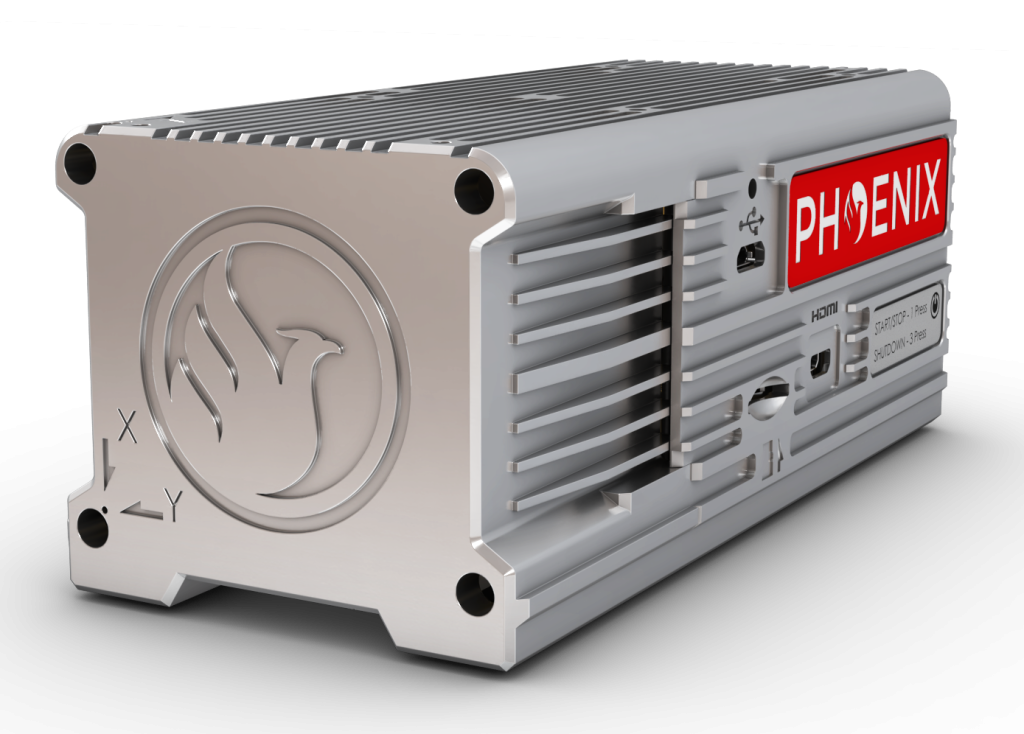
58.5 x 123 x 48.1mm
450g
CONSTELLATION SUPPORT:
GPS+GLONASS+BEIDOU +GALILEO
SUPPORT ALIGNMENT:
Kinematic
OPERATION MODES:
Post-processing only
POSITION ACCURACY:
0.5 cm (PPK Estimated)
ATTITUDE ACCURACY:
<0.01° Pitch & Roll; <0.05° Heading
OVERALL DIMENSIONS:
18.9 x 13.1 x 13.8 cm
PAYLOAD WEIGHT:
1.8 kg / 3.97 lbs
CAMERA FOV:
70°
CAMERA RESOLUTION:
24 MP
EXTERNAL STORAGE:
256GB USB drive included
POWER CONSUMPTION:
20 W (typical)
OPERATING VOLTAGE:
12-28 V DC
OPERATING TEMPERATURE:
-20°C – +40°C
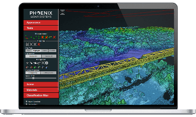
Phoenix LiDAR Systems provides a proprietary complete software suite for streamlined acquisition, geo-referencing, data fusion, export and post-processing in the cloud.