RedTail’s integration process provides world-class turn-key solutions. The RTL-450 is system agnostic, allowing the customer to select their sUAS of choice. The RedTail team provides all mounting, calibration, testing, and hands-on training to ensure the customer’s sUAS LiDAR system is ready to go from day one.
RedTail provides mounting, calibration, and boresighting to ensure the RTL-450 works perfectly right out of the box.
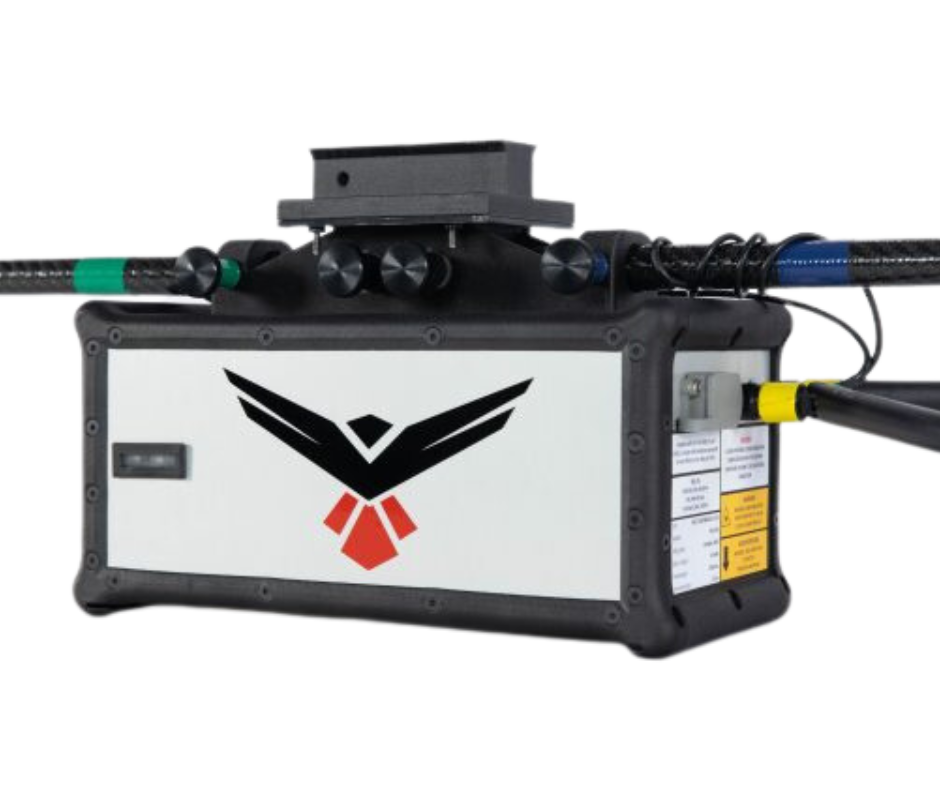
RedTail’s patented LiDAR sensor was designed and optimized for use on sUAS’. The integrated APX-18 GNSS/IMU makes the RTL-450 the ultimate drone LiDAR package.
The RTL-450 evenly distributes all data points on the ground, resulting in unprecedented data densities and point cloud resolution.
The RTL-450 unit weighs only 4.2 lbs. allowing for integration on a large variety of sUAS platforms.
The dual antennas come standard on the APX-18 increasing GPS accuracy, even when hovering.
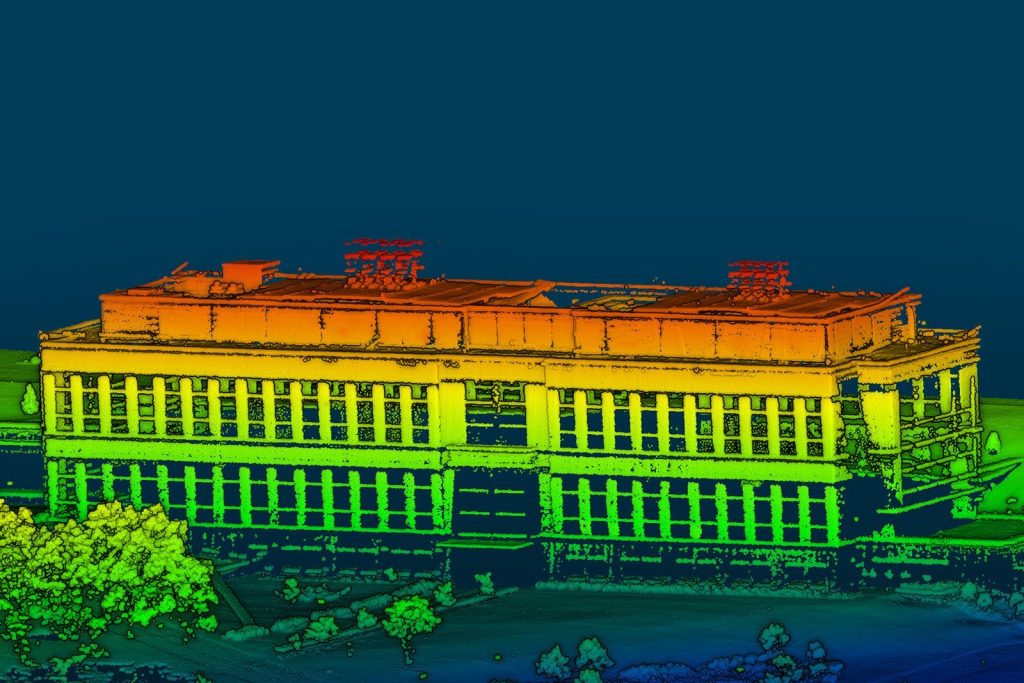
RedTail provides a lifetime license for our processing software. Our software, the RedTail Point Cloud generator (RTL-PCG), outputs a geo-referenced .las file.